Garmin BlueChart und Navionics Seekarten bei LEPPER marine
Als Nutzer von einem Garmin Gerät profitieren Sie von der Übernahme von Navionics durch Garmin. Viele Inhalte von Navionics fließen in die BlueChart Kartografie ein und parallel bietet Garmin spezielle Garmin Navionics+ und Garmin Navionics Vision+ Seekarten an.
Dieser Link zeigt Ihnen die Möglichkeiten Ihres Garmin Kartenplotters:
Vergleich Plotter Kompatibilität mit Garmin BlueChart und Garmin Navionics
Es ist wichtig zu beachten, dass die Seekarten in dieser Rubrik sowie den Unterrubriken ausschließlich mit entsprechend mordernen Garmin Kartenplottern (mit jeweils neuster Betriebssoftware) genutzt werden können.
Die Verwendung mit Plottern von Drittanbietern (außer Garmin) ist mit diesen Karten nicht möglich. Für andere Hersteller (sog. Navionics Drittanbieter Kartenplotter) außer Garmin schauen Sie bitte in dieser Rubrik

Details: Informationen Produktcode VEU059R Name Greenland East Typ Garmin BlueChart g3 Vision Abdeckung Detailed coverage of the Eastern coast of Greenland from Germania Land around the southern tip of Greenland to Godthab (Nuuk) on the SW coast: Also details Jameson Land, Ammassalik, Julianehåb (Qaqortoq), and Nanortalik. Kompatibilität siehe Reiter Kompatible Plotter Kartenupdate Hier klicken

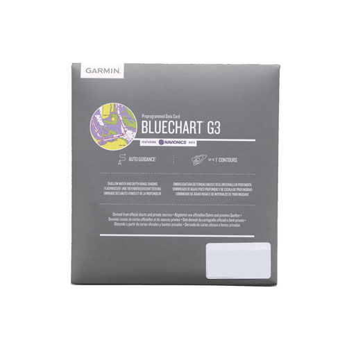
Hochwertige Karten Branchenführende Abdeckung, Klarheit und Detailgenauigkeit mit aktualisierten Seekarten, die Garmin und Navionics® Daten vereinen Auto Guidance1 zum schnellen Berechnen einer vorgeschlagenen Route unter Verwendung der gewünschten Tiefe und lichten Höhe Tiefenbereichschattierung für bis zu 10 Tiefenreichweiten, sodass du die Zieltiefe auf einen Blick siehst Tiefenlinien von bis zu 30 cm (1 Fuß) für eine genauere Darstellung der Gewässerbodenstrukturen und optimierte Angelkarten Zur klaren Anzeige von zu vermeidendem Flachwasser ermöglicht die Flachwasserschattierung eine Schattierung bei einer vom Benutzer angegebenen Tiefe Verlasse dich bei deinen Bootstouren auf eine ausgezeichnete Abdeckung und klare Details. BlueChart® g3-Karten bieten eine branchenführende Abdeckung, Klarheit und Details die Garmin und Navionics® Daten vereinen. Routenvorschlag Ob beim Angeln oder Cruising – wähle einen Punkt aus und erhalte eine Route, die den allgemeinen Verlauf sowie Hindernisse in der Nähe in einer sicheren Tiefe anzeigt1. Tiefenbereichschattierung Mit dieser Funktion werden hochauflösende Tiefenbereichschattierungen für bis zu 10 Tiefenbereiche angezeigt, sodass du die festgelegte Zieltiefe auf einen Blick siehst. Flachwasserschattierung Zur klaren Anzeige von zu vermeidendem Flachwasser ermöglicht diese Funktion eine Schattierung bei einer vom Benutzer angegebenen Tiefe. Detaillierte Tiefenlinien BlueChart g3-Karten zeigen Tiefenlinien von bis zu 30 cm (1 Fuß) an, wodurch Gewässerbodenstrukturen genauer dargestellt werden. Das Ergebnis sind optimierte Angelkarten und zusätzliche Details in Angelseen, Kanälen und anderen Häfen. 1Auto Guidance dient ausschließlich zu Planungszwecken und ersetzt nicht die Maßnahmen für eine sichere Navigation. Auto Guidance ist nicht in vorinstallierten BlueChart g3 Karten für Kartenplotter der ECHOMAP™ Plus Serie enthalten. Karte BlueChart® g3 EU001R Garmin Typ BlueChart g3 Kartographie See ja Kartographie Land nur in Küstennähe Kartographie Straße nein Verfügbare Speichermedien Je nach Plottermodell auf folgenden Speichermdien lieferbar. Siehe unten (010-C0760-20) auf microSD/SD-Karte Informationen HEU001R bzw. HXEU001R Name English Channel Abdeckung British coast: covers from Felixstowe to the Isles of Scilly, including Dover, The Solent, and the Isle of Wight. Also covers the River Thames from Twickenham to the North Sea. French coast: covers from Dunkerque to L'Aber Wrac'h, including Rouen and the Channel Islands Hersteller Link www.garmin.de Karten Update

Hochwertige Karten Branchenführende Abdeckung, Klarheit und Detailgenauigkeit mit aktualisierten Seekarten, die Garmin und Navionics® Daten vereinen Auto Guidance1 zum schnellen Berechnen einer vorgeschlagenen Route unter Verwendung der gewünschten Tiefe und lichten Höhe Tiefenbereichschattierung für bis zu 10 Tiefenreichweiten, sodass du die Zieltiefe auf einen Blick siehst Tiefenlinien von bis zu 30 cm (1 Fuß) für eine genauere Darstellung der Gewässerbodenstrukturen und optimierte Angelkarten Zur klaren Anzeige von zu vermeidendem Flachwasser ermöglicht die Flachwasserschattierung eine Schattierung bei einer vom Benutzer angegebenen Tiefe Verlasse dich bei deinen Bootstouren auf eine ausgezeichnete Abdeckung und klare Details. BlueChart® g3-Karten bieten eine branchenführende Abdeckung, Klarheit und Details die Garmin und Navionics® Daten vereinen. Routenvorschlag Ob beim Angeln oder Cruising – wähle einen Punkt aus und erhalte eine Route, die den allgemeinen Verlauf sowie Hindernisse in der Nähe in einer sicheren Tiefe anzeigt1. Tiefenbereichschattierung Mit dieser Funktion werden hochauflösende Tiefenbereichschattierungen für bis zu 10 Tiefenbereiche angezeigt, sodass du die festgelegte Zieltiefe auf einen Blick siehst. Flachwasserschattierung Zur klaren Anzeige von zu vermeidendem Flachwasser ermöglicht diese Funktion eine Schattierung bei einer vom Benutzer angegebenen Tiefe. Detaillierte Tiefenlinien BlueChart g3-Karten zeigen Tiefenlinien von bis zu 30 cm (1 Fuß) an, wodurch Gewässerbodenstrukturen genauer dargestellt werden. Das Ergebnis sind optimierte Angelkarten und zusätzliche Details in Angelseen, Kanälen und anderen Häfen. 1Auto Guidance dient ausschließlich zu Planungszwecken und ersetzt nicht die Maßnahmen für eine sichere Navigation. Auto Guidance ist nicht in vorinstallierten BlueChart g3 Karten für Kartenplotter der ECHOMAP™ Plus Serie enthalten. Karte BlueChart® g3 EU002R Garmin Typ BlueChart g3 Kartographie See ja Kartographie Land nur in Küstennähe Kartographie Straße nein Verfügbare Speichermedien Je nach Plottermodell auf folgenden Speichermdien lieferbar. Siehe unten (010-C0761-20) auf microSD/SD-Karte (010-C0761-10) auf Garmin DataCard Informationen HEU002R bzw. HXEU002R Name Dover to Amsterdam and England Southeast Abdeckung British coast: from Scarborough Harbour to Newhaven, including River Thames to London. Continental coast: from Amsterdam to Fecamp Hersteller Link www.garmin.de Karten Update

Hochwertige Karten Branchenführende Abdeckung, Klarheit und Detailgenauigkeit mit aktualisierten Seekarten, die Garmin und Navionics® Daten vereinen Auto Guidance1 zum schnellen Berechnen einer vorgeschlagenen Route unter Verwendung der gewünschten Tiefe und lichten Höhe Tiefenbereichschattierung für bis zu 10 Tiefenreichweiten, sodass du die Zieltiefe auf einen Blick siehst Tiefenlinien von bis zu 30 cm (1 Fuß) für eine genauere Darstellung der Gewässerbodenstrukturen und optimierte Angelkarten Zur klaren Anzeige von zu vermeidendem Flachwasser ermöglicht die Flachwasserschattierung eine Schattierung bei einer vom Benutzer angegebenen Tiefe Verlasse dich bei deinen Bootstouren auf eine ausgezeichnete Abdeckung und klare Details. BlueChart® g3-Karten bieten eine branchenführende Abdeckung, Klarheit und Details die Garmin und Navionics® Daten vereinen. Routenvorschlag Ob beim Angeln oder Cruising – wähle einen Punkt aus und erhalte eine Route, die den allgemeinen Verlauf sowie Hindernisse in der Nähe in einer sicheren Tiefe anzeigt1. Tiefenbereichschattierung Mit dieser Funktion werden hochauflösende Tiefenbereichschattierungen für bis zu 10 Tiefenbereiche angezeigt, sodass du die festgelegte Zieltiefe auf einen Blick siehst. Flachwasserschattierung Zur klaren Anzeige von zu vermeidendem Flachwasser ermöglicht diese Funktion eine Schattierung bei einer vom Benutzer angegebenen Tiefe. Detaillierte Tiefenlinien BlueChart g3-Karten zeigen Tiefenlinien von bis zu 30 cm (1 Fuß) an, wodurch Gewässerbodenstrukturen genauer dargestellt werden. Das Ergebnis sind optimierte Angelkarten und zusätzliche Details in Angelseen, Kanälen und anderen Häfen. 1Auto Guidance dient ausschließlich zu Planungszwecken und ersetzt nicht die Maßnahmen für eine sichere Navigation. Auto Guidance ist nicht in vorinstallierten BlueChart g3 Karten für Kartenplotter der ECHOMAP™ Plus Serie enthalten. Karte BlueChart® g3 EU003R Garmin Typ BlueChart g3 Kartographie See ja Kartographie Land nur in Küstennähe Kartographie Straße nein Verfügbare Speichermedien Je nach Plottermodell auf folgenden Speichermdien lieferbar. Siehe unten (010-C0762-20) auf microSD/SD-Karte Informationen HEU003R bzw. HXEU003R Name Great Britain, Northeast Coast Abdeckung Covers from the Isle of Lewis, Scotland to Bridlington Harbour, England, including Gairloch, the Shetland Islands, Edinburgh, and North Sea offshore charts. Also includes the Caledonian Canal, Loch Linnhe, and Loch Ness. Hersteller Link www.garmin.de Karten Update

Hochwertige Karten Branchenführende Abdeckung, Klarheit und Detailgenauigkeit mit aktualisierten Seekarten, die Garmin und Navionics® Daten vereinen Auto Guidance1 zum schnellen Berechnen einer vorgeschlagenen Route unter Verwendung der gewünschten Tiefe und lichten Höhe Tiefenbereichschattierung für bis zu 10 Tiefenreichweiten, sodass du die Zieltiefe auf einen Blick siehst Tiefenlinien von bis zu 30 cm (1 Fuß) für eine genauere Darstellung der Gewässerbodenstrukturen und optimierte Angelkarten Zur klaren Anzeige von zu vermeidendem Flachwasser ermöglicht die Flachwasserschattierung eine Schattierung bei einer vom Benutzer angegebenen Tiefe Verlasse dich bei deinen Bootstouren auf eine ausgezeichnete Abdeckung und klare Details. BlueChart® g3-Karten bieten eine branchenführende Abdeckung, Klarheit und Details die Garmin und Navionics® Daten vereinen. Routenvorschlag Ob beim Angeln oder Cruising – wähle einen Punkt aus und erhalte eine Route, die den allgemeinen Verlauf sowie Hindernisse in der Nähe in einer sicheren Tiefe anzeigt1. Tiefenbereichschattierung Mit dieser Funktion werden hochauflösende Tiefenbereichschattierungen für bis zu 10 Tiefenbereiche angezeigt, sodass du die festgelegte Zieltiefe auf einen Blick siehst. Flachwasserschattierung Zur klaren Anzeige von zu vermeidendem Flachwasser ermöglicht diese Funktion eine Schattierung bei einer vom Benutzer angegebenen Tiefe. Detaillierte Tiefenlinien BlueChart g3-Karten zeigen Tiefenlinien von bis zu 30 cm (1 Fuß) an, wodurch Gewässerbodenstrukturen genauer dargestellt werden. Das Ergebnis sind optimierte Angelkarten und zusätzliche Details in Angelseen, Kanälen und anderen Häfen. 1Auto Guidance dient ausschließlich zu Planungszwecken und ersetzt nicht die Maßnahmen für eine sichere Navigation. Auto Guidance ist nicht in vorinstallierten BlueChart g3 Karten für Kartenplotter der ECHOMAP™ Plus Serie enthalten. Karte BlueChart® g3 EU004R Garmin Typ BlueChart g3 Kartographie See ja Kartographie Land nur in Küstennähe Kartographie Straße nein Verfügbare Speichermedien Je nach Plottermodell auf folgenden Speichermdien lieferbar. Siehe unten (010-C0763-20) auf microSD/SD-Karte Informationen HEU004R bzw. HXEU004R Name Irish Sea Abdeckung British coast: covers from Port Ellen on the Isle of Islay to Falmouth, including the Isle of Man and the Isles of Scilly. Irish coast: covers from Sheep Haven to Caherciveen, Republic of Ireland, including Londonderry, The Storks, Belfast, and Dublin. Hersteller Link www.garmin.de Karten Update

Hochwertige Karten Branchenführende Abdeckung, Klarheit und Detailgenauigkeit mit aktualisierten Seekarten, die Garmin und Navionics® Daten vereinen Auto Guidance1 zum schnellen Berechnen einer vorgeschlagenen Route unter Verwendung der gewünschten Tiefe und lichten Höhe Tiefenbereichschattierung für bis zu 10 Tiefenreichweiten, sodass du die Zieltiefe auf einen Blick siehst Tiefenlinien von bis zu 30 cm (1 Fuß) für eine genauere Darstellung der Gewässerbodenstrukturen und optimierte Angelkarten Zur klaren Anzeige von zu vermeidendem Flachwasser ermöglicht die Flachwasserschattierung eine Schattierung bei einer vom Benutzer angegebenen Tiefe Verlasse dich bei deinen Bootstouren auf eine ausgezeichnete Abdeckung und klare Details. BlueChart® g3-Karten bieten eine branchenführende Abdeckung, Klarheit und Details die Garmin und Navionics® Daten vereinen. Routenvorschlag Ob beim Angeln oder Cruising – wähle einen Punkt aus und erhalte eine Route, die den allgemeinen Verlauf sowie Hindernisse in der Nähe in einer sicheren Tiefe anzeigt1. Tiefenbereichschattierung Mit dieser Funktion werden hochauflösende Tiefenbereichschattierungen für bis zu 10 Tiefenbereiche angezeigt, sodass du die festgelegte Zieltiefe auf einen Blick siehst. Flachwasserschattierung Zur klaren Anzeige von zu vermeidendem Flachwasser ermöglicht diese Funktion eine Schattierung bei einer vom Benutzer angegebenen Tiefe. Detaillierte Tiefenlinien BlueChart g3-Karten zeigen Tiefenlinien von bis zu 30 cm (1 Fuß) an, wodurch Gewässerbodenstrukturen genauer dargestellt werden. Das Ergebnis sind optimierte Angelkarten und zusätzliche Details in Angelseen, Kanälen und anderen Häfen. 1Auto Guidance dient ausschließlich zu Planungszwecken und ersetzt nicht die Maßnahmen für eine sichere Navigation. Auto Guidance ist nicht in vorinstallierten BlueChart g3 Karten für Kartenplotter der ECHOMAP™ Plus Serie enthalten. Karte BlueChart® g3 EU005R Garmin Typ BlueChart g3 Kartographie See ja Kartographie Land nur in Küstennähe Kartographie Straße nein Verfügbare Speichermedien Je nach Plottermodell auf folgenden Speichermdien lieferbar. Siehe unten (010-C0764-20) auf microSD/SD-Karte Informationen HEU005R bzw. HXEU005R Name Ireland, West Coast Abdeckung Detailed coverage of the north and western coasts of Ireland from Cork to Belfast including the Shannon Inland and Shannon-Erne Waterways, Galway Bay and Lough Neagh. Also included is the southwestern Scottish coast from Colonsay to Campbeltown. Hersteller Link www.garmin.de Karten Update

Hochwertige Karten Branchenführende Abdeckung, Klarheit und Detailgenauigkeit mit aktualisierten Seekarten, die Garmin und Navionics® Daten vereinen Auto Guidance1 zum schnellen Berechnen einer vorgeschlagenen Route unter Verwendung der gewünschten Tiefe und lichten Höhe Tiefenbereichschattierung für bis zu 10 Tiefenreichweiten, sodass du die Zieltiefe auf einen Blick siehst Tiefenlinien von bis zu 30 cm (1 Fuß) für eine genauere Darstellung der Gewässerbodenstrukturen und optimierte Angelkarten Zur klaren Anzeige von zu vermeidendem Flachwasser ermöglicht die Flachwasserschattierung eine Schattierung bei einer vom Benutzer angegebenen Tiefe Verlasse dich bei deinen Bootstouren auf eine ausgezeichnete Abdeckung und klare Details. BlueChart® g3-Karten bieten eine branchenführende Abdeckung, Klarheit und Details die Garmin und Navionics® Daten vereinen. Routenvorschlag Ob beim Angeln oder Cruising – wähle einen Punkt aus und erhalte eine Route, die den allgemeinen Verlauf sowie Hindernisse in der Nähe in einer sicheren Tiefe anzeigt1. Tiefenbereichschattierung Mit dieser Funktion werden hochauflösende Tiefenbereichschattierungen für bis zu 10 Tiefenbereiche angezeigt, sodass du die festgelegte Zieltiefe auf einen Blick siehst. Flachwasserschattierung Zur klaren Anzeige von zu vermeidendem Flachwasser ermöglicht diese Funktion eine Schattierung bei einer vom Benutzer angegebenen Tiefe. Detaillierte Tiefenlinien BlueChart g3-Karten zeigen Tiefenlinien von bis zu 30 cm (1 Fuß) an, wodurch Gewässerbodenstrukturen genauer dargestellt werden. Das Ergebnis sind optimierte Angelkarten und zusätzliche Details in Angelseen, Kanälen und anderen Häfen. 1Auto Guidance dient ausschließlich zu Planungszwecken und ersetzt nicht die Maßnahmen für eine sichere Navigation. Auto Guidance ist nicht in vorinstallierten BlueChart g3 Karten für Kartenplotter der ECHOMAP™ Plus Serie enthalten. Karte BlueChart® g3 EU006R Garmin Typ BlueChart g3 Kartographie See ja Kartographie Land nur in Küstennähe Kartographie Straße nein Verfügbare Speichermedien Je nach Plottermodell auf folgenden Speichermdien lieferbar. Siehe unten (010-C0765-20) auf microSD/SD-Karte Informationen HEU006R bzw. HXEU006R Name Scotland, West Coast Abdeckung Scottish coast: Covers from the Isle of Lewis and Loch Bervie to Campbeltown Harbour and Girvan, including Glasgow, Ayr, and the islands of Skye, Arran, and many others. Hersteller Link www.garmin.de Karten Update

Hochwertige Karten Branchenführende Abdeckung, Klarheit und Detailgenauigkeit mit aktualisierten Seekarten, die Garmin und Navionics® Daten vereinen Auto Guidance1 zum schnellen Berechnen einer vorgeschlagenen Route unter Verwendung der gewünschten Tiefe und lichten Höhe Tiefenbereichschattierung für bis zu 10 Tiefenreichweiten, sodass du die Zieltiefe auf einen Blick siehst Tiefenlinien von bis zu 30 cm (1 Fuß) für eine genauere Darstellung der Gewässerbodenstrukturen und optimierte Angelkarten Zur klaren Anzeige von zu vermeidendem Flachwasser ermöglicht die Flachwasserschattierung eine Schattierung bei einer vom Benutzer angegebenen Tiefe Verlasse dich bei deinen Bootstouren auf eine ausgezeichnete Abdeckung und klare Details. BlueChart® g3-Karten bieten eine branchenführende Abdeckung, Klarheit und Details die Garmin und Navionics® Daten vereinen. Routenvorschlag Ob beim Angeln oder Cruising – wähle einen Punkt aus und erhalte eine Route, die den allgemeinen Verlauf sowie Hindernisse in der Nähe in einer sicheren Tiefe anzeigt1. Tiefenbereichschattierung Mit dieser Funktion werden hochauflösende Tiefenbereichschattierungen für bis zu 10 Tiefenbereiche angezeigt, sodass du die festgelegte Zieltiefe auf einen Blick siehst. Flachwasserschattierung Zur klaren Anzeige von zu vermeidendem Flachwasser ermöglicht diese Funktion eine Schattierung bei einer vom Benutzer angegebenen Tiefe. Detaillierte Tiefenlinien BlueChart g3-Karten zeigen Tiefenlinien von bis zu 30 cm (1 Fuß) an, wodurch Gewässerbodenstrukturen genauer dargestellt werden. Das Ergebnis sind optimierte Angelkarten und zusätzliche Details in Angelseen, Kanälen und anderen Häfen. 1Auto Guidance dient ausschließlich zu Planungszwecken und ersetzt nicht die Maßnahmen für eine sichere Navigation. Auto Guidance ist nicht in vorinstallierten BlueChart g3 Karten für Kartenplotter der ECHOMAP™ Plus Serie enthalten. Karte BlueChart® g3 EU008R Garmin Typ BlueChart g3 Kartographie See ja Kartographie Land nur in Küstennähe Kartographie Straße nein Verfügbare Speichermedien Je nach Plottermodell auf folgenden Speichermdien lieferbar. Siehe unten (010-C0766-20) auf microSD/SD-Karte Informationen HEU008R bzw. HXEU008R Name Bay of Biscay Abdeckung From Binic, France to Cabo Finisterre, Spain. Hersteller Link www.garmin.de Karten Update

Hochwertige Karten Branchenführende Abdeckung, Klarheit und Detailgenauigkeit mit aktualisierten Seekarten, die Garmin und Navionics® Daten vereinen Auto Guidance1 zum schnellen Berechnen einer vorgeschlagenen Route unter Verwendung der gewünschten Tiefe und lichten Höhe Tiefenbereichschattierung für bis zu 10 Tiefenreichweiten, sodass du die Zieltiefe auf einen Blick siehst Tiefenlinien von bis zu 30 cm (1 Fuß) für eine genauere Darstellung der Gewässerbodenstrukturen und optimierte Angelkarten Zur klaren Anzeige von zu vermeidendem Flachwasser ermöglicht die Flachwasserschattierung eine Schattierung bei einer vom Benutzer angegebenen Tiefe Verlasse dich bei deinen Bootstouren auf eine ausgezeichnete Abdeckung und klare Details. BlueChart® g3-Karten bieten eine branchenführende Abdeckung, Klarheit und Details die Garmin und Navionics® Daten vereinen. Routenvorschlag Ob beim Angeln oder Cruising – wähle einen Punkt aus und erhalte eine Route, die den allgemeinen Verlauf sowie Hindernisse in der Nähe in einer sicheren Tiefe anzeigt1. Tiefenbereichschattierung Mit dieser Funktion werden hochauflösende Tiefenbereichschattierungen für bis zu 10 Tiefenbereiche angezeigt, sodass du die festgelegte Zieltiefe auf einen Blick siehst. Flachwasserschattierung Zur klaren Anzeige von zu vermeidendem Flachwasser ermöglicht diese Funktion eine Schattierung bei einer vom Benutzer angegebenen Tiefe. Detaillierte Tiefenlinien BlueChart g3-Karten zeigen Tiefenlinien von bis zu 30 cm (1 Fuß) an, wodurch Gewässerbodenstrukturen genauer dargestellt werden. Das Ergebnis sind optimierte Angelkarten und zusätzliche Details in Angelseen, Kanälen und anderen Häfen. 1Auto Guidance dient ausschließlich zu Planungszwecken und ersetzt nicht die Maßnahmen für eine sichere Navigation. Auto Guidance ist nicht in vorinstallierten BlueChart g3 Karten für Kartenplotter der ECHOMAP™ Plus Serie enthalten. Karte BlueChart® g3 EU009R Garmin Typ BlueChart g3 Kartographie See ja Kartographie Land nur in Küstennähe Kartographie Straße nein Verfügbare Speichermedien Je nach Plottermodell auf folgenden Speichermdien lieferbar. Siehe unten (010-C0767-20) auf microSD/SD-Karte Informationen HEU009R bzw. HXEU009R Name Portugal and Northwest Spain Abdeckung From Gijón to Cadiz and Sevilla, including the entire coast for Portugal. Hersteller Link www.garmin.de Karten Update

Hochwertige Karten Branchenführende Abdeckung, Klarheit und Detailgenauigkeit mit aktualisierten Seekarten, die Garmin und Navionics® Daten vereinen Auto Guidance1 zum schnellen Berechnen einer vorgeschlagenen Route unter Verwendung der gewünschten Tiefe und lichten Höhe Tiefenbereichschattierung für bis zu 10 Tiefenreichweiten, sodass du die Zieltiefe auf einen Blick siehst Tiefenlinien von bis zu 30 cm (1 Fuß) für eine genauere Darstellung der Gewässerbodenstrukturen und optimierte Angelkarten Zur klaren Anzeige von zu vermeidendem Flachwasser ermöglicht die Flachwasserschattierung eine Schattierung bei einer vom Benutzer angegebenen Tiefe Verlasse dich bei deinen Bootstouren auf eine ausgezeichnete Abdeckung und klare Details. BlueChart® g3-Karten bieten eine branchenführende Abdeckung, Klarheit und Details die Garmin und Navionics® Daten vereinen. Routenvorschlag Ob beim Angeln oder Cruising – wähle einen Punkt aus und erhalte eine Route, die den allgemeinen Verlauf sowie Hindernisse in der Nähe in einer sicheren Tiefe anzeigt1. Tiefenbereichschattierung Mit dieser Funktion werden hochauflösende Tiefenbereichschattierungen für bis zu 10 Tiefenbereiche angezeigt, sodass du die festgelegte Zieltiefe auf einen Blick siehst. Flachwasserschattierung Zur klaren Anzeige von zu vermeidendem Flachwasser ermöglicht diese Funktion eine Schattierung bei einer vom Benutzer angegebenen Tiefe. Detaillierte Tiefenlinien BlueChart g3-Karten zeigen Tiefenlinien von bis zu 30 cm (1 Fuß) an, wodurch Gewässerbodenstrukturen genauer dargestellt werden. Das Ergebnis sind optimierte Angelkarten und zusätzliche Details in Angelseen, Kanälen und anderen Häfen. 1Auto Guidance dient ausschließlich zu Planungszwecken und ersetzt nicht die Maßnahmen für eine sichere Navigation. Auto Guidance ist nicht in vorinstallierten BlueChart g3 Karten für Kartenplotter der ECHOMAP™ Plus Serie enthalten. Karte BlueChart® g3 EU010R Garmin Typ BlueChart g3 Kartographie See ja Kartographie Land nur in Küstennähe Kartographie Straße nein Verfügbare Speichermedien Je nach Plottermodell auf folgenden Speichermdien lieferbar. Siehe unten (010-C0768-20) auf microSD/SD-Karte Informationen HEU010R bzw. HXEU010R Name Spain, Mediterranean Coast Abdeckung Detailed coverage of the entire Spanish and French Mediterranean coast from the Straight of Gibraltar to La Spezia, IT. Includes coverage of Corse, the northern part of Sardegna, and the Islas Baleares. Also covers the northern coasts of Morocco and Algeria from Larache, MA, to Bejaia, DZ. Hersteller Link www.garmin.de Karten Update

Hochwertige Karten Branchenführende Abdeckung, Klarheit und Detailgenauigkeit mit aktualisierten Seekarten, die Garmin und Navionics® Daten vereinen Auto Guidance1 zum schnellen Berechnen einer vorgeschlagenen Route unter Verwendung der gewünschten Tiefe und lichten Höhe Tiefenbereichschattierung für bis zu 10 Tiefenreichweiten, sodass du die Zieltiefe auf einen Blick siehst Tiefenlinien von bis zu 30 cm (1 Fuß) für eine genauere Darstellung der Gewässerbodenstrukturen und optimierte Angelkarten Zur klaren Anzeige von zu vermeidendem Flachwasser ermöglicht die Flachwasserschattierung eine Schattierung bei einer vom Benutzer angegebenen Tiefe Verlasse dich bei deinen Bootstouren auf eine ausgezeichnete Abdeckung und klare Details. BlueChart® g3-Karten bieten eine branchenführende Abdeckung, Klarheit und Details die Garmin und Navionics® Daten vereinen. Routenvorschlag Ob beim Angeln oder Cruising – wähle einen Punkt aus und erhalte eine Route, die den allgemeinen Verlauf sowie Hindernisse in der Nähe in einer sicheren Tiefe anzeigt1. Tiefenbereichschattierung Mit dieser Funktion werden hochauflösende Tiefenbereichschattierungen für bis zu 10 Tiefenbereiche angezeigt, sodass du die festgelegte Zieltiefe auf einen Blick siehst. Flachwasserschattierung Zur klaren Anzeige von zu vermeidendem Flachwasser ermöglicht diese Funktion eine Schattierung bei einer vom Benutzer angegebenen Tiefe. Detaillierte Tiefenlinien BlueChart g3-Karten zeigen Tiefenlinien von bis zu 30 cm (1 Fuß) an, wodurch Gewässerbodenstrukturen genauer dargestellt werden. Das Ergebnis sind optimierte Angelkarten und zusätzliche Details in Angelseen, Kanälen und anderen Häfen. 1Auto Guidance dient ausschließlich zu Planungszwecken und ersetzt nicht die Maßnahmen für eine sichere Navigation. Auto Guidance ist nicht in vorinstallierten BlueChart g3 Karten für Kartenplotter der ECHOMAP™ Plus Serie enthalten. Karte BlueChart® g3 EU012R Garmin Typ BlueChart g3 Kartographie See ja Kartographie Land nur in Küstennähe Kartographie Straße nein Verfügbare Speichermedien Je nach Plottermodell auf folgenden Speichermdien lieferbar. Siehe unten (010-C0770-20) auf microSD/SD-Karte Informationen HEU012R bzw. HXEU012R Name Mediterranean Sea, Central-West Abdeckung Detailed coverage of the Mediterranean coast from Llafranc, ES to Crotone, IT including the coasts of France, Monaco, and the west coast of Italy. Also includes detailed coverage of Lago Maggiore, Lago di Lugano, Lago d'Iseo, Lago di Como and Lago di Garda in northern Italy. Island coverage features Corse, Sardegna, Sicilia, and Malta. Hersteller Link www.garmin.de Karten Update

Hochwertige Karten Branchenführende Abdeckung, Klarheit und Detailgenauigkeit mit aktualisierten Seekarten, die Garmin und Navionics® Daten vereinen Auto Guidance1 zum schnellen Berechnen einer vorgeschlagenen Route unter Verwendung der gewünschten Tiefe und lichten Höhe Tiefenbereichschattierung für bis zu 10 Tiefenreichweiten, sodass du die Zieltiefe auf einen Blick siehst Tiefenlinien von bis zu 30 cm (1 Fuß) für eine genauere Darstellung der Gewässerbodenstrukturen und optimierte Angelkarten Zur klaren Anzeige von zu vermeidendem Flachwasser ermöglicht die Flachwasserschattierung eine Schattierung bei einer vom Benutzer angegebenen Tiefe Verlasse dich bei deinen Bootstouren auf eine ausgezeichnete Abdeckung und klare Details. BlueChart® g3-Karten bieten eine branchenführende Abdeckung, Klarheit und Details die Garmin und Navionics® Daten vereinen. Routenvorschlag Ob beim Angeln oder Cruising – wähle einen Punkt aus und erhalte eine Route, die den allgemeinen Verlauf sowie Hindernisse in der Nähe in einer sicheren Tiefe anzeigt1. Tiefenbereichschattierung Mit dieser Funktion werden hochauflösende Tiefenbereichschattierungen für bis zu 10 Tiefenbereiche angezeigt, sodass du die festgelegte Zieltiefe auf einen Blick siehst. Flachwasserschattierung Zur klaren Anzeige von zu vermeidendem Flachwasser ermöglicht diese Funktion eine Schattierung bei einer vom Benutzer angegebenen Tiefe. Detaillierte Tiefenlinien BlueChart g3-Karten zeigen Tiefenlinien von bis zu 30 cm (1 Fuß) an, wodurch Gewässerbodenstrukturen genauer dargestellt werden. Das Ergebnis sind optimierte Angelkarten und zusätzliche Details in Angelseen, Kanälen und anderen Häfen. 1Auto Guidance dient ausschließlich zu Planungszwecken und ersetzt nicht die Maßnahmen für eine sichere Navigation. Auto Guidance ist nicht in vorinstallierten BlueChart g3 Karten für Kartenplotter der ECHOMAP™ Plus Serie enthalten. Karte BlueChart® g3 EU013R Garmin Typ BlueChart g3 Kartographie See ja Kartographie Land nur in Küstennähe Kartographie Straße nein Verfügbare Speichermedien Je nach Plottermodell auf folgenden Speichermdien lieferbar. Siehe unten (010-C0771-20) auf microSD/SD-Karte Informationen HEU013R bzw. HXEU013R Name Italy Southwest and Tunisia Abdeckung Italian coast: from Isola d'Ischia, south to Reggio Calabria, northeast to Brindisi, including Sicilia and southern part of Sardegna. African coast: from Golfe de Bejaia, Algeria to Banghazi, Libya. Hersteller Link www.garmin.de Karten Update

Details zur Seekarte Karte BlueChart® g3 EU014R Garmin Typ BlueChart g3 Kartographie See Kartographie Land nur in Küstennähe Kartographie Straße nein Verfügbare Speichermedien Je nach Plottermodell auf folgenden Speichermdien lieferbar. Siehe unten (010-C0772-20) auf microSD/SD-Karte Informationen HXEU014R Name Italy, Adriatic Sea, Italien Adria komplett Abdeckung Detailed coverage of several Italian lakes, the Po River and the Adriatic coast of Italy, Slovenia, Croatia, Albania, the western coast of Greece and southern Italy. Coverage includes eastern Sicily, the Straits of Messina, the Dalmatian Coast, the Gulf of Taranto, Lago Maggiore, Lago d'Iseo, Lago di Como and Lago d'Garda.

Hochwertige Karten Branchenführende Abdeckung, Klarheit und Detailgenauigkeit mit aktualisierten Seekarten, die Garmin und Navionics® Daten vereinen Auto Guidance1 zum schnellen Berechnen einer vorgeschlagenen Route unter Verwendung der gewünschten Tiefe und lichten Höhe Tiefenbereichschattierung für bis zu 10 Tiefenreichweiten, sodass du die Zieltiefe auf einen Blick siehst Tiefenlinien von bis zu 30 cm (1 Fuß) für eine genauere Darstellung der Gewässerbodenstrukturen und optimierte Angelkarten Zur klaren Anzeige von zu vermeidendem Flachwasser ermöglicht die Flachwasserschattierung eine Schattierung bei einer vom Benutzer angegebenen Tiefe Verlasse dich bei deinen Bootstouren auf eine ausgezeichnete Abdeckung und klare Details. BlueChart® g3-Karten bieten eine branchenführende Abdeckung, Klarheit und Details die Garmin und Navionics® Daten vereinen. Routenvorschlag Ob beim Angeln oder Cruising – wähle einen Punkt aus und erhalte eine Route, die den allgemeinen Verlauf sowie Hindernisse in der Nähe in einer sicheren Tiefe anzeigt1. Tiefenbereichschattierung Mit dieser Funktion werden hochauflösende Tiefenbereichschattierungen für bis zu 10 Tiefenbereiche angezeigt, sodass du die festgelegte Zieltiefe auf einen Blick siehst. Flachwasserschattierung Zur klaren Anzeige von zu vermeidendem Flachwasser ermöglicht diese Funktion eine Schattierung bei einer vom Benutzer angegebenen Tiefe. Detaillierte Tiefenlinien BlueChart g3-Karten zeigen Tiefenlinien von bis zu 30 cm (1 Fuß) an, wodurch Gewässerbodenstrukturen genauer dargestellt werden. Das Ergebnis sind optimierte Angelkarten und zusätzliche Details in Angelseen, Kanälen und anderen Häfen. 1Auto Guidance dient ausschließlich zu Planungszwecken und ersetzt nicht die Maßnahmen für eine sichere Navigation. Auto Guidance ist nicht in vorinstallierten BlueChart g3 Karten für Kartenplotter der ECHOMAP™ Plus Serie enthalten. Karte BlueChart® g3 EU015R Garmin Typ BlueChart g3 Kartographie See ja Kartographie Land nur in Küstennähe Kartographie Straße nein Verfügbare Speichermedien Je nach Plottermodell auf folgenden Speichermdien lieferbar. Siehe unten (010-C0773-20) auf microSD/SD-Karte Informationen HEU015R bzw. HXEU015R Name Aegean Sea and Sea of Marmara Abdeckung Including all of the Greek coast and Aegean Sea; Turkey from Istanbul and Sea of Marmara to Antalya; and Brindisi, Italy. Hersteller Link www.garmin.de Karten Update

Hochwertige Karten Branchenführende Abdeckung, Klarheit und Detailgenauigkeit mit aktualisierten Seekarten, die Garmin und Navionics® Daten vereinen Auto Guidance1 zum schnellen Berechnen einer vorgeschlagenen Route unter Verwendung der gewünschten Tiefe und lichten Höhe Tiefenbereichschattierung für bis zu 10 Tiefenreichweiten, sodass du die Zieltiefe auf einen Blick siehst Tiefenlinien von bis zu 30 cm (1 Fuß) für eine genauere Darstellung der Gewässerbodenstrukturen und optimierte Angelkarten Zur klaren Anzeige von zu vermeidendem Flachwasser ermöglicht die Flachwasserschattierung eine Schattierung bei einer vom Benutzer angegebenen Tiefe Verlasse dich bei deinen Bootstouren auf eine ausgezeichnete Abdeckung und klare Details. BlueChart® g3-Karten bieten eine branchenführende Abdeckung, Klarheit und Details die Garmin und Navionics® Daten vereinen. Routenvorschlag Ob beim Angeln oder Cruising – wähle einen Punkt aus und erhalte eine Route, die den allgemeinen Verlauf sowie Hindernisse in der Nähe in einer sicheren Tiefe anzeigt1. Tiefenbereichschattierung Mit dieser Funktion werden hochauflösende Tiefenbereichschattierungen für bis zu 10 Tiefenbereiche angezeigt, sodass du die festgelegte Zieltiefe auf einen Blick siehst. Flachwasserschattierung Zur klaren Anzeige von zu vermeidendem Flachwasser ermöglicht diese Funktion eine Schattierung bei einer vom Benutzer angegebenen Tiefe. Detaillierte Tiefenlinien BlueChart g3-Karten zeigen Tiefenlinien von bis zu 30 cm (1 Fuß) an, wodurch Gewässerbodenstrukturen genauer dargestellt werden. Das Ergebnis sind optimierte Angelkarten und zusätzliche Details in Angelseen, Kanälen und anderen Häfen. 1Auto Guidance dient ausschließlich zu Planungszwecken und ersetzt nicht die Maßnahmen für eine sichere Navigation. Auto Guidance ist nicht in vorinstallierten BlueChart g3 Karten für Kartenplotter der ECHOMAP™ Plus Serie enthalten. Karte BlueChart® g3 EU016R Garmin Typ BlueChart g3 Kartographie See ja Kartographie Land nur in Küstennähe Kartographie Straße nein Verfügbare Speichermedien Je nach Plottermodell auf folgenden Speichermdien lieferbar. Siehe unten (010-C0774-20) auf microSD/SD-Karte Informationen HEU016R bzw. HXEU016R Name Mediterranean Southeast Abdeckung From Güllük, Turkey east to include Cyprus, Syria, Lebanon and Israel, then west to Misratah, Libya. Hersteller Link www.garmin.de Karten Update

Hochwertige Karten Branchenführende Abdeckung, Klarheit und Detailgenauigkeit mit aktualisierten Seekarten, die Garmin und Navionics® Daten vereinen Auto Guidance1 zum schnellen Berechnen einer vorgeschlagenen Route unter Verwendung der gewünschten Tiefe und lichten Höhe Tiefenbereichschattierung für bis zu 10 Tiefenreichweiten, sodass du die Zieltiefe auf einen Blick siehst Tiefenlinien von bis zu 30 cm (1 Fuß) für eine genauere Darstellung der Gewässerbodenstrukturen und optimierte Angelkarten Zur klaren Anzeige von zu vermeidendem Flachwasser ermöglicht die Flachwasserschattierung eine Schattierung bei einer vom Benutzer angegebenen Tiefe Verlasse dich bei deinen Bootstouren auf eine ausgezeichnete Abdeckung und klare Details. BlueChart® g3-Karten bieten eine branchenführende Abdeckung, Klarheit und Details die Garmin und Navionics® Daten vereinen. Routenvorschlag Ob beim Angeln oder Cruising – wähle einen Punkt aus und erhalte eine Route, die den allgemeinen Verlauf sowie Hindernisse in der Nähe in einer sicheren Tiefe anzeigt1. Tiefenbereichschattierung Mit dieser Funktion werden hochauflösende Tiefenbereichschattierungen für bis zu 10 Tiefenbereiche angezeigt, sodass du die festgelegte Zieltiefe auf einen Blick siehst. Flachwasserschattierung Zur klaren Anzeige von zu vermeidendem Flachwasser ermöglicht diese Funktion eine Schattierung bei einer vom Benutzer angegebenen Tiefe. Detaillierte Tiefenlinien BlueChart g3-Karten zeigen Tiefenlinien von bis zu 30 cm (1 Fuß) an, wodurch Gewässerbodenstrukturen genauer dargestellt werden. Das Ergebnis sind optimierte Angelkarten und zusätzliche Details in Angelseen, Kanälen und anderen Häfen. Hinweis 1: Auto Guidance dient ausschließlich zu Planungszwecken und ersetzt nicht die Maßnahmen für eine sichere Navigation. Auto Guidance ist nicht in vorinstallierten BlueChart g3 Karten für Kartenplotter der ECHOMAP™ Plus Serie enthalten. Karte BlueChart® g3 EU018R Garmin Typ BlueChart g3 Kartographie See ja Kartographie Land nur in Küstennähe Kartographie Straße nein Informationen HXEU018R Name The Netherlands Abdeckung Continental coverage: from Spiekeroog, Germany to Calais, France, including The Netherlands and Belgium coast entirely. Great Britain coverage: from Whitstable to Folkestone.

Hochwertige Karten Branchenführende Abdeckung, Klarheit und Detailgenauigkeit mit aktualisierten Seekarten, die Garmin und Navionics® Daten vereinen Auto Guidance1 zum schnellen Berechnen einer vorgeschlagenen Route unter Verwendung der gewünschten Tiefe und lichten Höhe Tiefenbereichschattierung für bis zu 10 Tiefenreichweiten, sodass du die Zieltiefe auf einen Blick siehst Tiefenlinien von bis zu 30 cm (1 Fuß) für eine genauere Darstellung der Gewässerbodenstrukturen und optimierte Angelkarten Zur klaren Anzeige von zu vermeidendem Flachwasser ermöglicht die Flachwasserschattierung eine Schattierung bei einer vom Benutzer angegebenen Tiefe Verlasse dich bei deinen Bootstouren auf eine ausgezeichnete Abdeckung und klare Details. BlueChart® g3-Karten bieten eine branchenführende Abdeckung, Klarheit und Details die Garmin und Navionics® Daten vereinen. Routenvorschlag Ob beim Angeln oder Cruising – wähle einen Punkt aus und erhalte eine Route, die den allgemeinen Verlauf sowie Hindernisse in der Nähe in einer sicheren Tiefe anzeigt1. Tiefenbereichschattierung Mit dieser Funktion werden hochauflösende Tiefenbereichschattierungen für bis zu 10 Tiefenbereiche angezeigt, sodass du die festgelegte Zieltiefe auf einen Blick siehst. Flachwasserschattierung Zur klaren Anzeige von zu vermeidendem Flachwasser ermöglicht diese Funktion eine Schattierung bei einer vom Benutzer angegebenen Tiefe. Detaillierte Tiefenlinien BlueChart g3-Karten zeigen Tiefenlinien von bis zu 30 cm (1 Fuß) an, wodurch Gewässerbodenstrukturen genauer dargestellt werden. Das Ergebnis sind optimierte Angelkarten und zusätzliche Details in Angelseen, Kanälen und anderen Häfen. 1Auto Guidance dient ausschließlich zu Planungszwecken und ersetzt nicht die Maßnahmen für eine sichere Navigation. Auto Guidance ist nicht in vorinstallierten BlueChart g3 Karten für Kartenplotter der ECHOMAP™ Plus Serie enthalten. Karte BlueChart® g3 EU019 Garmin Typ BlueChart g3 Kartographie See ja Kartographie Land nur in Küstennähe Kartographie Straße nein Verfügbare Speichermedien Je nach Plottermodell auf folgenden Speichermdien lieferbar. Siehe unten (010-C0776-20) auf microSD/SD-Karte Informationen HEU019R bzw. HXEU019R Name Alborg to Amsterdam Abdeckung Includes detailed coverage from Ålborg Bugt to Amsterdam, The Netherlands, including Limfjorden, Hamburg, Bremen and Emden. Hersteller Link www.garmin.de Karten Update

Hochwertige Karten Branchenführende Abdeckung, Klarheit und Detailgenauigkeit mit aktualisierten Seekarten, die Garmin und Navionics® Daten vereinen Auto Guidance1 zum schnellen Berechnen einer vorgeschlagenen Route unter Verwendung der gewünschten Tiefe und lichten Höhe Tiefenbereichschattierung für bis zu 10 Tiefenreichweiten, sodass du die Zieltiefe auf einen Blick siehst Tiefenlinien von bis zu 30 cm (1 Fuß) für eine genauere Darstellung der Gewässerbodenstrukturen und optimierte Angelkarten Zur klaren Anzeige von zu vermeidendem Flachwasser ermöglicht die Flachwasserschattierung eine Schattierung bei einer vom Benutzer angegebenen Tiefe Verlasse dich bei deinen Bootstouren auf eine ausgezeichnete Abdeckung und klare Details. BlueChart® g3-Karten bieten eine branchenführende Abdeckung, Klarheit und Details die Garmin und Navionics® Daten vereinen. Routenvorschlag Ob beim Angeln oder Cruising – wähle einen Punkt aus und erhalte eine Route, die den allgemeinen Verlauf sowie Hindernisse in der Nähe in einer sicheren Tiefe anzeigt1. Tiefenbereichschattierung Mit dieser Funktion werden hochauflösende Tiefenbereichschattierungen für bis zu 10 Tiefenbereiche angezeigt, sodass du die festgelegte Zieltiefe auf einen Blick siehst. Flachwasserschattierung Zur klaren Anzeige von zu vermeidendem Flachwasser ermöglicht diese Funktion eine Schattierung bei einer vom Benutzer angegebenen Tiefe. Detaillierte Tiefenlinien BlueChart g3-Karten zeigen Tiefenlinien von bis zu 30 cm (1 Fuß) an, wodurch Gewässerbodenstrukturen genauer dargestellt werden. Das Ergebnis sind optimierte Angelkarten und zusätzliche Details in Angelseen, Kanälen und anderen Häfen. 1Auto Guidance dient ausschließlich zu Planungszwecken und ersetzt nicht die Maßnahmen für eine sichere Navigation. Auto Guidance ist nicht in vorinstallierten BlueChart g3 Karten für Kartenplotter der ECHOMAP™ Plus Serie enthalten. Karte BlueChart® g3 HXEU021R Garmin Typ BlueChart g3 Kartographie See ja Kartographie Land nur in Küstennähe Kartographie Straße nein Verfügbare Speichermedien 010-C0777-20 auf microSD/SD-Karte Informationen HXEU021R Name Århus-Kiel-Koszalin Abdeckung Swedish coast: from Hoganas to Karlskrona, including Malmö. Danish, German, and Polish coasts: from Århus to Koszalin, including Sjælland, Fyn, Møn, Falster, Lolland, Langeland and Fehmarn. Hersteller Link www.garmin.de Karten Update

Hochwertige Karten Branchenführende Abdeckung, Klarheit und Detailgenauigkeit mit aktualisierten Seekarten, die Garmin und Navionics® Daten vereinen Auto Guidance1 zum schnellen Berechnen einer vorgeschlagenen Route unter Verwendung der gewünschten Tiefe und lichten Höhe Tiefenbereichschattierung für bis zu 10 Tiefenreichweiten, sodass du die Zieltiefe auf einen Blick siehst Tiefenlinien von bis zu 30 cm (1 Fuß) für eine genauere Darstellung der Gewässerbodenstrukturen und optimierte Angelkarten Zur klaren Anzeige von zu vermeidendem Flachwasser ermöglicht die Flachwasserschattierung eine Schattierung bei einer vom Benutzer angegebenen Tiefe Verlasse dich bei deinen Bootstouren auf eine ausgezeichnete Abdeckung und klare Details. BlueChart® g3-Karten bieten eine branchenführende Abdeckung, Klarheit und Details die Garmin und Navionics® Daten vereinen. Routenvorschlag Ob beim Angeln oder Cruising – wähle einen Punkt aus und erhalte eine Route, die den allgemeinen Verlauf sowie Hindernisse in der Nähe in einer sicheren Tiefe anzeigt1. Tiefenbereichschattierung Mit dieser Funktion werden hochauflösende Tiefenbereichschattierungen für bis zu 10 Tiefenbereiche angezeigt, sodass du die festgelegte Zieltiefe auf einen Blick siehst. Flachwasserschattierung Zur klaren Anzeige von zu vermeidendem Flachwasser ermöglicht diese Funktion eine Schattierung bei einer vom Benutzer angegebenen Tiefe. Detaillierte Tiefenlinien BlueChart g3-Karten zeigen Tiefenlinien von bis zu 30 cm (1 Fuß) an, wodurch Gewässerbodenstrukturen genauer dargestellt werden. Das Ergebnis sind optimierte Angelkarten und zusätzliche Details in Angelseen, Kanälen und anderen Häfen. 1Auto Guidance dient ausschließlich zu Planungszwecken und ersetzt nicht die Maßnahmen für eine sichere Navigation. Auto Guidance ist nicht in vorinstallierten BlueChart g3 Karten für Kartenplotter der ECHOMAP™ Plus Serie enthalten. Karte BlueChart® g3 EU041R Garmin Typ BlueChart g3 Kartographie See ja Kartographie Land nur in Küstennähe Kartographie Straße nein Verfügbare Speichermedien Je nach Plottermodell auf folgenden Speichermdien lieferbar. Siehe unten (010-C0778-20) auf microSD/SD-Karte Informationen HEU041R bzw. HXEU041R Name Oslo-Skagerak-Haugesund Abdeckung Detailed coverage of the Norwegian and Swedish coasts from Skånevik, NO to Göteborg, SE including Boknafjorden, Oslofjorden, the Skagerrak, Lake Mjøsa, Lake Bandak, Lake Kviteseidvatnet, Lake Flåvatn, Lake Norsjø, Lake Heddalsvatnet, the Telemark Canal, the upper Kattegat and the island of Laeso. Hersteller Link www.garmin.de Karten Update

Hochwertige Karten Branchenführende Abdeckung, Klarheit und Detailgenauigkeit mit aktualisierten Seekarten, die Garmin und Navionics® Daten vereinen Auto Guidance1 zum schnellen Berechnen einer vorgeschlagenen Route unter Verwendung der gewünschten Tiefe und lichten Höhe Tiefenbereichschattierung für bis zu 10 Tiefenreichweiten, sodass du die Zieltiefe auf einen Blick siehst Tiefenlinien von bis zu 30 cm (1 Fuß) für eine genauere Darstellung der Gewässerbodenstrukturen und optimierte Angelkarten Zur klaren Anzeige von zu vermeidendem Flachwasser ermöglicht die Flachwasserschattierung eine Schattierung bei einer vom Benutzer angegebenen Tiefe Verlasse dich bei deinen Bootstouren auf eine ausgezeichnete Abdeckung und klare Details. BlueChart® g3-Karten bieten eine branchenführende Abdeckung, Klarheit und Details die Garmin und Navionics® Daten vereinen. Routenvorschlag Ob beim Angeln oder Cruising – wähle einen Punkt aus und erhalte eine Route, die den allgemeinen Verlauf sowie Hindernisse in der Nähe in einer sicheren Tiefe anzeigt1. Tiefenbereichschattierung Mit dieser Funktion werden hochauflösende Tiefenbereichschattierungen für bis zu 10 Tiefenbereiche angezeigt, sodass du die festgelegte Zieltiefe auf einen Blick siehst. Flachwasserschattierung Zur klaren Anzeige von zu vermeidendem Flachwasser ermöglicht diese Funktion eine Schattierung bei einer vom Benutzer angegebenen Tiefe. Detaillierte Tiefenlinien BlueChart g3-Karten zeigen Tiefenlinien von bis zu 30 cm (1 Fuß) an, wodurch Gewässerbodenstrukturen genauer dargestellt werden. Das Ergebnis sind optimierte Angelkarten und zusätzliche Details in Angelseen, Kanälen und anderen Häfen. 1Auto Guidance dient ausschließlich zu Planungszwecken und ersetzt nicht die Maßnahmen für eine sichere Navigation. Auto Guidance ist nicht in vorinstallierten BlueChart g3 Karten für Kartenplotter der ECHOMAP™ Plus Serie enthalten. Karte BlueChart® g3 EU042R Garmin Typ BlueChart g3 Kartographie See ja Kartographie Land nur in Küstennähe Kartographie Straße nein Verfügbare Speichermedien Je nach Plottermodell auf folgenden Speichermdien lieferbar. Siehe unten (010-C0779-20) auf microSD/SD-Karte Informationen HEU042R bzw. HXEU042R Name Oslo-Trelleborg Abdeckung Detailed coverage of the Norwegian and Swedish coasts from Grimstad, NO to Ystad, SE including Oslo, NO and Malmö, SE. Also includes coverage of the Danish coast from Hirtshals through Copenhagen, the Skagerrak, the Kattegat, the Orosund, the island of Laeso, and Lakes Fryken, Vänern, Vättern, Mjörn, Sommen, Nommen, and Bolmen in Sweden. Hersteller Link www.garmin.de Karten Update

Hochwertige Karten Branchenführende Abdeckung, Klarheit und Detailgenauigkeit mit aktualisierten Seekarten, die Garmin und Navionics® Daten vereinen Auto Guidance1 zum schnellen Berechnen einer vorgeschlagenen Route unter Verwendung der gewünschten Tiefe und lichten Höhe Tiefenbereichschattierung für bis zu 10 Tiefenreichweiten, sodass du die Zieltiefe auf einen Blick siehst Tiefenlinien von bis zu 30 cm (1 Fuß) für eine genauere Darstellung der Gewässerbodenstrukturen und optimierte Angelkarten Zur klaren Anzeige von zu vermeidendem Flachwasser ermöglicht die Flachwasserschattierung eine Schattierung bei einer vom Benutzer angegebenen Tiefe Verlasse dich bei deinen Bootstouren auf eine ausgezeichnete Abdeckung und klare Details. BlueChart® g3-Karten bieten eine branchenführende Abdeckung, Klarheit und Details die Garmin und Navionics® Daten vereinen. Routenvorschlag Ob beim Angeln oder Cruising – wähle einen Punkt aus und erhalte eine Route, die den allgemeinen Verlauf sowie Hindernisse in der Nähe in einer sicheren Tiefe anzeigt1. Tiefenbereichschattierung Mit dieser Funktion werden hochauflösende Tiefenbereichschattierungen für bis zu 10 Tiefenbereiche angezeigt, sodass du die festgelegte Zieltiefe auf einen Blick siehst. Flachwasserschattierung Zur klaren Anzeige von zu vermeidendem Flachwasser ermöglicht diese Funktion eine Schattierung bei einer vom Benutzer angegebenen Tiefe. Detaillierte Tiefenlinien BlueChart g3-Karten zeigen Tiefenlinien von bis zu 30 cm (1 Fuß) an, wodurch Gewässerbodenstrukturen genauer dargestellt werden. Das Ergebnis sind optimierte Angelkarten und zusätzliche Details in Angelseen, Kanälen und anderen Häfen. 1Auto Guidance dient ausschließlich zu Planungszwecken und ersetzt nicht die Maßnahmen für eine sichere Navigation. Auto Guidance ist nicht in vorinstallierten BlueChart g3 Karten für Kartenplotter der ECHOMAP™ Plus Serie enthalten. Karte BlueChart® g3 EU043R Garmin Typ BlueChart g3 Kartographie See ja Kartographie Land nur in Küstennähe Kartographie Straße nein Verfügbare Speichermedien Je nach Plottermodell auf folgenden Speichermdien lieferbar. Siehe unten (010-C0780-20) auf microSD/SD-Karte Informationen HEU043R bzw. HXEU043R Name Iceland & Faeroe Island Abdeckung Includes detailed coverage of all of Iceland including the cities of Reykjavik and Akureyri. Also includes detailed coverage of the Faeroe Islands including Stromo, Ostero, Sydero and Bordo Islands. Hersteller Link www.garmin.de Karten Update

Hochwertige Karten Branchenführende Abdeckung, Klarheit und Detailgenauigkeit mit aktualisierten Seekarten, die Garmin und Navionics® Daten vereinen Auto Guidance1 zum schnellen Berechnen einer vorgeschlagenen Route unter Verwendung der gewünschten Tiefe und lichten Höhe Tiefenbereichschattierung für bis zu 10 Tiefenreichweiten, sodass du die Zieltiefe auf einen Blick siehst Tiefenlinien von bis zu 30 cm (1 Fuß) für eine genauere Darstellung der Gewässerbodenstrukturen und optimierte Angelkarten Zur klaren Anzeige von zu vermeidendem Flachwasser ermöglicht die Flachwasserschattierung eine Schattierung bei einer vom Benutzer angegebenen Tiefe Verlasse dich bei deinen Bootstouren auf eine ausgezeichnete Abdeckung und klare Details. BlueChart® g3-Karten bieten eine branchenführende Abdeckung, Klarheit und Details die Garmin und Navionics® Daten vereinen. Routenvorschlag Ob beim Angeln oder Cruising – wähle einen Punkt aus und erhalte eine Route, die den allgemeinen Verlauf sowie Hindernisse in der Nähe in einer sicheren Tiefe anzeigt1. Tiefenbereichschattierung Mit dieser Funktion werden hochauflösende Tiefenbereichschattierungen für bis zu 10 Tiefenbereiche angezeigt, sodass du die festgelegte Zieltiefe auf einen Blick siehst. Flachwasserschattierung Zur klaren Anzeige von zu vermeidendem Flachwasser ermöglicht diese Funktion eine Schattierung bei einer vom Benutzer angegebenen Tiefe. Detaillierte Tiefenlinien BlueChart g3-Karten zeigen Tiefenlinien von bis zu 30 cm (1 Fuß) an, wodurch Gewässerbodenstrukturen genauer dargestellt werden. Das Ergebnis sind optimierte Angelkarten und zusätzliche Details in Angelseen, Kanälen und anderen Häfen. 1Auto Guidance dient ausschließlich zu Planungszwecken und ersetzt nicht die Maßnahmen für eine sichere Navigation. Auto Guidance ist nicht in vorinstallierten BlueChart g3 Karten für Kartenplotter der ECHOMAP™ Plus Serie enthalten. Karte BlueChart® g3 EU046R Garmin Typ BlueChart g3 Kartographie See ja Kartographie Land nur in Küstennähe Kartographie Straße nein Verfügbare Speichermedien Je nach Plottermodell auf folgenden Speichermdien lieferbar. Siehe unten (010-C0782-20) auf microSD/SD-Karte Informationen HEU046R bzw. HXEU046R Name Sweden South-West Abdeckung Detailed coverage of the south and east coasts of Sweden from Helsingborg to Gävle including Trelleborg, Nykoping, Stockholm, Norrtalje, Karlsborg as well as Copenhagen, DK. Coverage of lakes include Lakes Vänern, Vättern, Sommen, Siljan, Fryken and Helgasjön; as well as coverage of the lower Dalälven from Gysinge to Söderfors and of the Strömsholms Kanal to Smedjebacken. Island coverage includes Bornholm DK, Oland and Gotland SE, and Åland, FI. Finnish coverage also extends to Turku and Hanko. Hersteller Link www.garmin.de Karten Update

Hochwertige Karten Branchenführende Abdeckung, Klarheit und Detailgenauigkeit mit aktualisierten Seekarten, die Garmin und Navionics® Daten vereinen Auto Guidance1 zum schnellen Berechnen einer vorgeschlagenen Route unter Verwendung der gewünschten Tiefe und lichten Höhe Tiefenbereichschattierung für bis zu 10 Tiefenreichweiten, sodass du die Zieltiefe auf einen Blick siehst Tiefenlinien von bis zu 30 cm (1 Fuß) für eine genauere Darstellung der Gewässerbodenstrukturen und optimierte Angelkarten Zur klaren Anzeige von zu vermeidendem Flachwasser ermöglicht die Flachwasserschattierung eine Schattierung bei einer vom Benutzer angegebenen Tiefe Verlasse dich bei deinen Bootstouren auf eine ausgezeichnete Abdeckung und klare Details. BlueChart® g3-Karten bieten eine branchenführende Abdeckung, Klarheit und Details die Garmin und Navionics® Daten vereinen. Routenvorschlag Ob beim Angeln oder Cruising – wähle einen Punkt aus und erhalte eine Route, die den allgemeinen Verlauf sowie Hindernisse in der Nähe in einer sicheren Tiefe anzeigt1. Tiefenbereichschattierung Mit dieser Funktion werden hochauflösende Tiefenbereichschattierungen für bis zu 10 Tiefenbereiche angezeigt, sodass du die festgelegte Zieltiefe auf einen Blick siehst. Flachwasserschattierung Zur klaren Anzeige von zu vermeidendem Flachwasser ermöglicht diese Funktion eine Schattierung bei einer vom Benutzer angegebenen Tiefe. Detaillierte Tiefenlinien BlueChart g3-Karten zeigen Tiefenlinien von bis zu 30 cm (1 Fuß) an, wodurch Gewässerbodenstrukturen genauer dargestellt werden. Das Ergebnis sind optimierte Angelkarten und zusätzliche Details in Angelseen, Kanälen und anderen Häfen. 1Auto Guidance dient ausschließlich zu Planungszwecken und ersetzt nicht die Maßnahmen für eine sichere Navigation. Auto Guidance ist nicht in vorinstallierten BlueChart g3 Karten für Kartenplotter der ECHOMAP™ Plus Serie enthalten. Karte BlueChart® g3 EU047R Garmin Typ BlueChart g3 Kartographie See ja Kartographie Land nur in Küstennähe Kartographie Straße nein Verfügbare Speichermedien Je nach Plottermodell auf folgenden Speichermdien lieferbar. Siehe unten (010-C0783-20) auf microSD/SD-Karte Informationen HEU047R bzw. HXEU047R Name Gulf of Bothnia - Kalix to Grisslehamn Abdeckung Detailed coverage of the Gulf of Bothnia from Gavle, SE through Pori, FI including Oulu and Vaasa, FI. Swedish coverage includes Luleå Skärgård, and Lakes Tjeggelvas, Hornavan, Siljan, Aisjaur, Fluka, Uddjaur, Storavan, Revsundssjön and Storsjön as well as coverage of the lower Dalälven from Gysinge to Söderfors. Coverage of the islands of Hailuoto, Vallgrund, and Åland is also included. Hersteller Link www.garmin.de Karten Update

Hochwertige Karten Branchenführende Abdeckung, Klarheit und Detailgenauigkeit mit aktualisierten Seekarten, die Garmin und Navionics® Daten vereinen Auto Guidance1 zum schnellen Berechnen einer vorgeschlagenen Route unter Verwendung der gewünschten Tiefe und lichten Höhe Tiefenbereichschattierung für bis zu 10 Tiefenreichweiten, sodass du die Zieltiefe auf einen Blick siehst Tiefenlinien von bis zu 30 cm (1 Fuß) für eine genauere Darstellung der Gewässerbodenstrukturen und optimierte Angelkarten Zur klaren Anzeige von zu vermeidendem Flachwasser ermöglicht die Flachwasserschattierung eine Schattierung bei einer vom Benutzer angegebenen Tiefe Verlasse dich bei deinen Bootstouren auf eine ausgezeichnete Abdeckung und klare Details. BlueChart® g3-Karten bieten eine branchenführende Abdeckung, Klarheit und Details die Garmin und Navionics® Daten vereinen. Routenvorschlag Ob beim Angeln oder Cruising – wähle einen Punkt aus und erhalte eine Route, die den allgemeinen Verlauf sowie Hindernisse in der Nähe in einer sicheren Tiefe anzeigt1. Tiefenbereichschattierung Mit dieser Funktion werden hochauflösende Tiefenbereichschattierungen für bis zu 10 Tiefenbereiche angezeigt, sodass du die festgelegte Zieltiefe auf einen Blick siehst. Flachwasserschattierung Zur klaren Anzeige von zu vermeidendem Flachwasser ermöglicht diese Funktion eine Schattierung bei einer vom Benutzer angegebenen Tiefe. Detaillierte Tiefenlinien BlueChart g3-Karten zeigen Tiefenlinien von bis zu 30 cm (1 Fuß) an, wodurch Gewässerbodenstrukturen genauer dargestellt werden. Das Ergebnis sind optimierte Angelkarten und zusätzliche Details in Angelseen, Kanälen und anderen Häfen. 1Auto Guidance dient ausschließlich zu Planungszwecken und ersetzt nicht die Maßnahmen für eine sichere Navigation. Auto Guidance ist nicht in vorinstallierten BlueChart g3 Karten für Kartenplotter der ECHOMAP™ Plus Serie enthalten. Karte BlueChart® g3 EU050R Garmin Typ BlueChart g3 Kartographie See ja Kartographie Land nur in Küstennähe Kartographie Straße nein Verfügbare Speichermedien Je nach Plottermodell auf folgenden Speichermdien lieferbar. Siehe unten (010-C0786-20) auf microSD/SD-Karte Informationen HEU050R bzw. HXEU050R Name Aland to Vyborg Abdeckung Detailed coverage of the Gulf of Finland from Åland to Vyborg, Finland. Also includes detailed coverage of the cities of Turku, Helsinki, and Kotka in Finland and Tallinn and Kohtla-Jarve in Estonia. Hersteller Link www.garmin.de Karten Update